October 9, 2018
Updating Kansas Weather Station Network
Submitted by Christopher Redmond

All data can be found online at mesonet.ksu.edu
New stations
The Kansas Mesonet has three new stations in operation – Elmdale 1SE in Chase County; Belleville 1W, in Republic County; and Ashland 8S, in Clark County. Elmdale and Ashland both fill significant data gaps in the state.
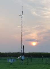
The Belleville station represents an upgrade for the Scandia Experiment Field tripod installation, the first of four upgrades to be supported by the Soybean Commission. The new tower, located on the Belleville site, adds an additional upper level (30-feet) wind and temperature information compared to the previous Scandia station. An additional temperature sensor at a higher height provides data for inversion monitoring. The Belleville station also adds a dual rain gauge and soil moisture measurements compared to the previous – matching the other Mesonet towers located through the state. At the end of this growing season, the Scandia Mesonet station will be discontinued.
Station metadata
The Mesonet station metadata webpage has also been enhanced: mesonet.ksu.edu/metadata. The intent of this update is to provide context to help users further understand the influences and history of the meteorological observations.
All stations are under stringent citing requirements via the World Meteorological Organization standards. However, minor influences such as ground cover type, distant obstructions, and changes over time are hard to disseminate with a few details. Therefore, we have added an interactive map, additional instrumentation details, and photos to help our users.
With photos being the biggest descriptor, the technician is required to take a minimum of four photos each station visit. The user can select previous trips and see the changes with seasonal and historical changes.
Lastly, we also added an opportunity to recognize groups/individuals that have provided yearly maintenance funding for a particular station. These “sponsors” help make the data possible over the years and we are always looking for more!
Improvements to the main page
The main page (mesonet.k-state.edu) provides the entrance point to all of our resources. Clicking on the “24-hr Precip” tab now shows not only station observations, but also an overlay of estimated rainfall for the past 24 hours. This gives a sense of rainfall in areas not covered by our stations, as well as some context for those times when nearby stations have very different measurements. The overlay comes from the National Weather Service Quantitative Precipitation Estimates and is calculated from radar data. Click the “About Map” button to get the time of update and find a link to the national precipitation map.
If you do not see anything as an overlay, it is because the precipitation was too little to be captured by the model. You can click on the “About this map” tab and follow the links to the national product. This will allow you to see what areas of the country did have precipitation.
Interactive wind barb feature
The “Wind” map shows the current wind speed and direction in a “wind barb.” If you have been wondering how to read this symbol, we have a new link to our Wind Barbs page (mesonet.k-state.edu/about/windbarbs/). Below the map, click “About This Map” and then “Interactive Wind Barbs Page.” You can use the inputs to change wind direction or speed and see how the barb reacts.
Questions? Problems? Want to see something added to the website? Please let us know at kansas-wdl@k-state.edu or contact us at 785-532-3029.